
A point cloud is not a map
Sweep an iPhone across a room and you get a dense scattering of measured points. It looks impressive. It is almost useless.
Nothing in that cloud says this is a wall or this is the way out. There are no rooms, no doorways, no floor — only positions. Everything that makes a place navigable has to be worked out from the arrangement of those points.
Finding the structure
Some of what a scan captures will still be true next year. Most of it will not. The useful work is telling them apart.
- Large flat runs of points, standing vertically, behave like walls
- A gap in an otherwise continuous wall behaves like a threshold — a way through
- The broad horizontal plane under everything is the floor, and a route has to lie on it
- A cluster of points at seat height in the middle of the room is a chair, and a chair is not architecture
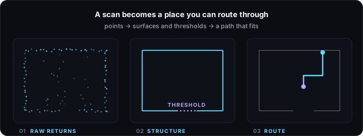
ICIDO keeps the first three and discards the fourth.
What survives a scan is the geometry that will still be there when you come back.
That choice has a practical consequence: routing around furniture that has since been moved would be worse than not knowing about it at all. A map that confidently steers you around a table which is no longer there has actively misled you.
Thresholds are the hard part
Walls are comparatively easy. Openings are where it gets interesting, because an opening is defined by absence — it is where the wall stops being there.
Get it wrong in one direction and the map thinks a solid wall has a door in it. Get it wrong in the other and a real doorway is invisible, so every route treats the room as sealed. Both failures are obvious the moment you try to walk the result, which is precisely why walking the result matters more than admiring the point cloud.
One coordinate frame, several floors
Rooms scanned separately are not much use if they float independently. ICIDO locks scanned levels into a shared coordinate frame, so a building becomes one continuous interior rather than a set of unrelated rooms — and a route can cross a floor, find the stairwell, and keep going up.
The home page has a diagram of this that you can scrub through, if you would rather see it than read about it.
And then the route
Once the geometry is understood, a path becomes a real question with a real answer. It has to lie on the floor, pass through openings that actually exist, keep sensible clearance from what is really in the way, and lead somewhere you asked to go.
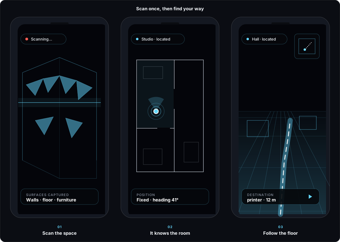
ICIDO draws that path onto the floor through the live camera and counts the remaining distance down as you walk. The overlay hides correctly behind real objects, because a route that appears to pass through a wall is not a route anyone should trust.